Portfolio
Selected Projects.
A showcase of my work in spatial analysis, precision cartography, and bespoke GIS development for conservation and urban environments.
Zambia
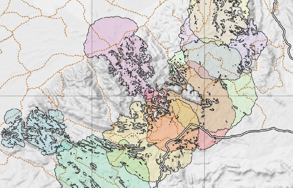
Conservation GIS
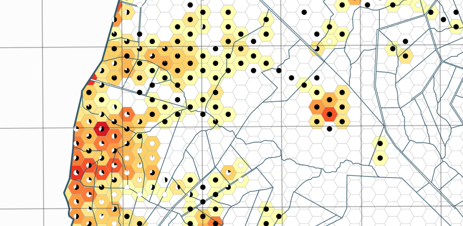
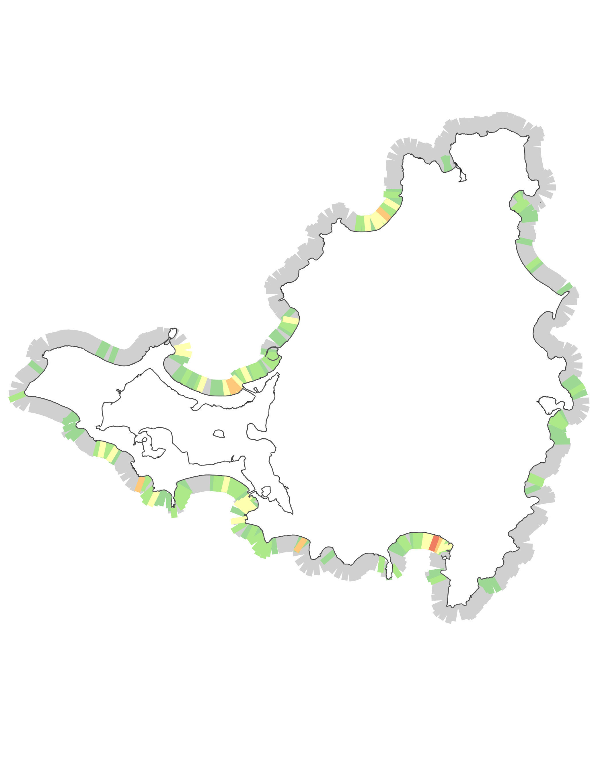
Ecological Intactness Mapping
A landscape integrity analysis within a partially developed region. This project visualises both the spatial extent of land degradation and the specific severity of human impact through integrated cartographic techniques.
Hydrology
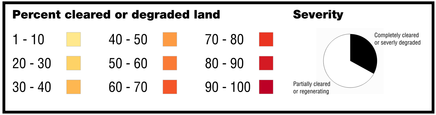
Watershed & Hydrological Analysis
Catchment and sub-catchment delineation using Digital Elevation Models (DEM) and the PCRaster suite. This work provides the hydrological foundation for sustainable water resource management.
Remote Sensing / AI
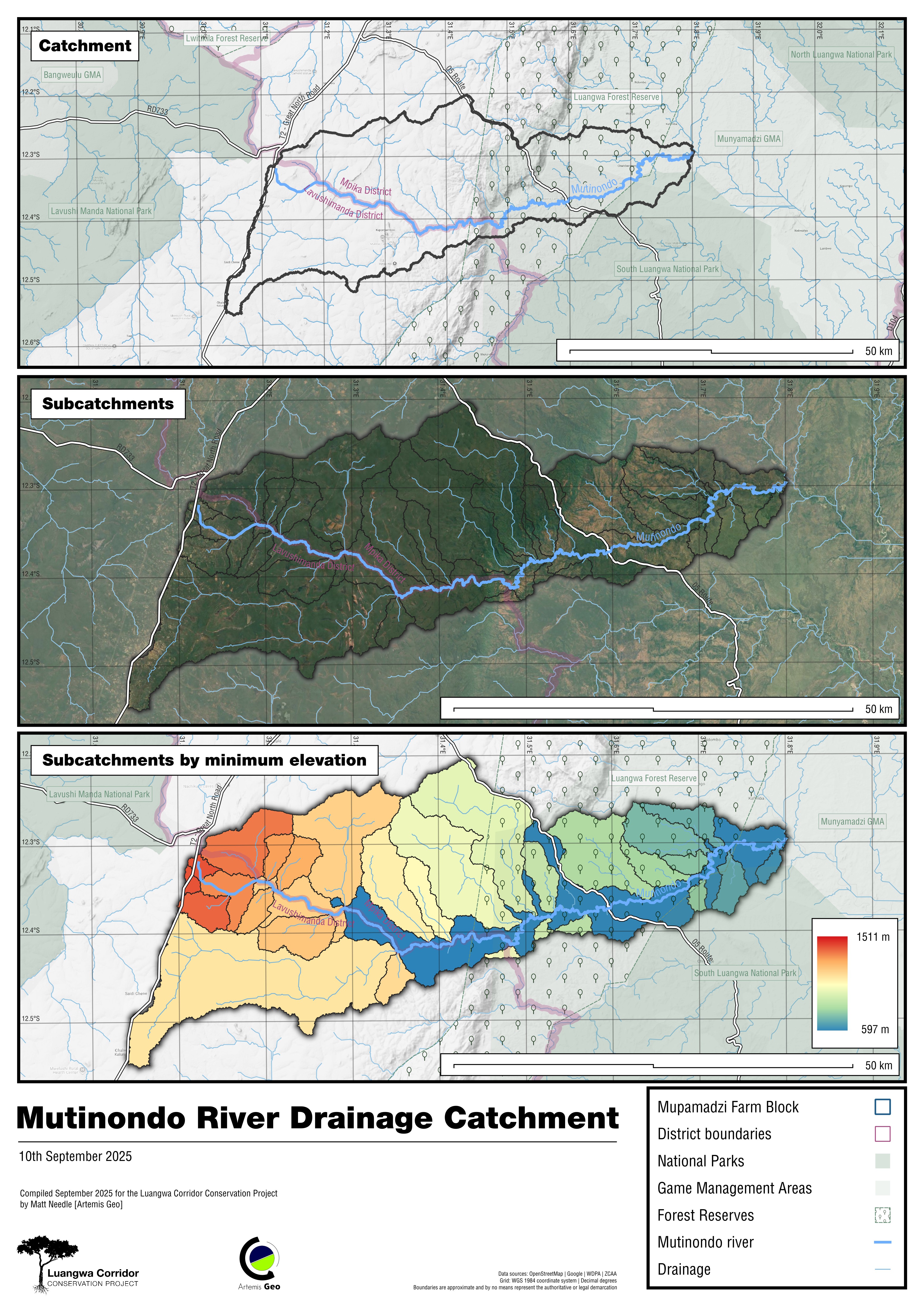
AI-Driven Deforestation Monitoring
An innovative workflow combining YOLO-based object detection for building footprints with the Segment Anything Model (SAM) to quantify tree cover loss. This automated approach ensures high-accuracy land-use change estimations for rapid environmental reporting.
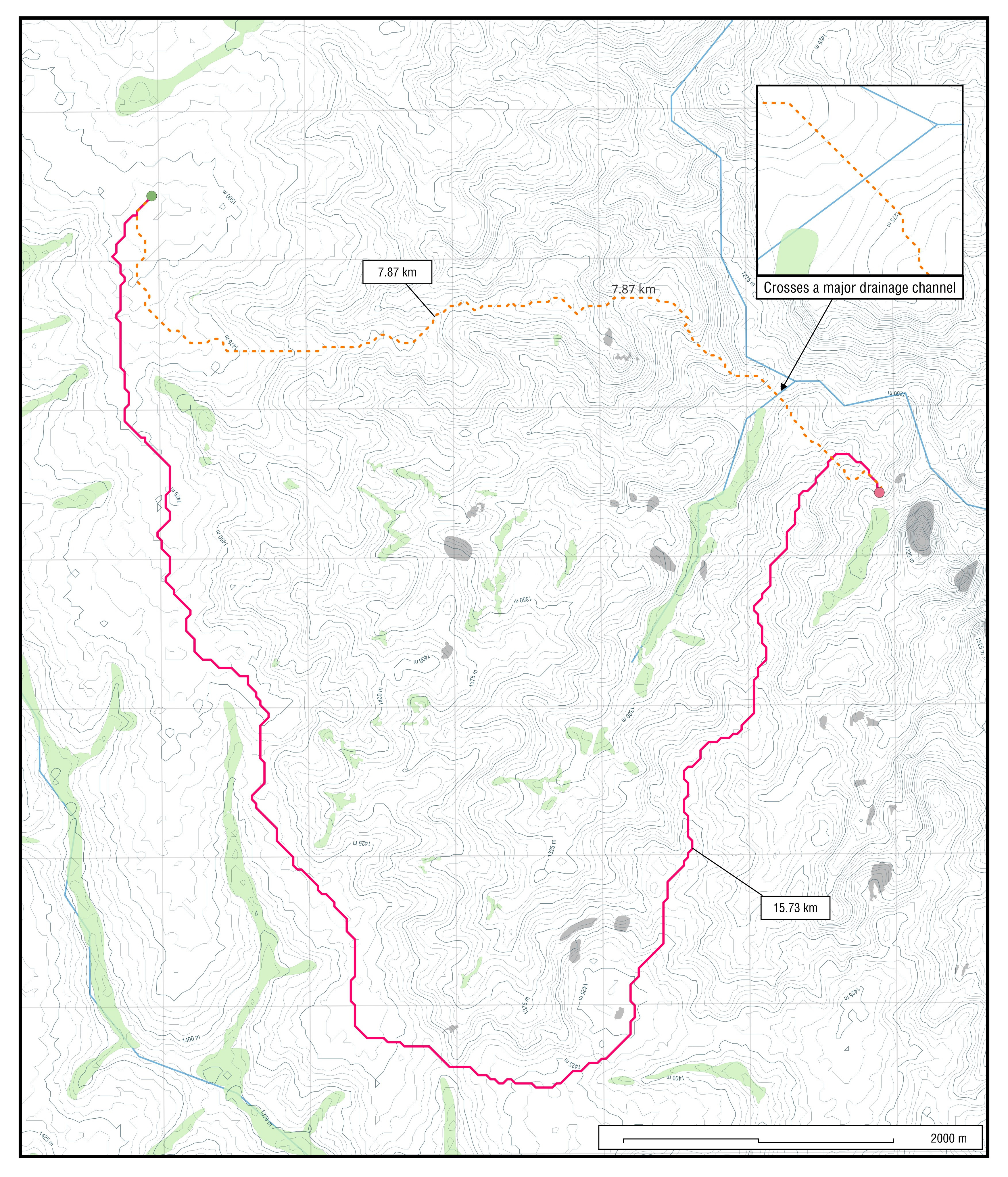
Spatial Modelling
Least-Cost Path Analysis
Advanced raster-based route optimisation through high-relief, rugged terrain. By calculating multi-factor cost surfaces, the model determines the most efficient and practical paths for logistics and field operations in remote environments.
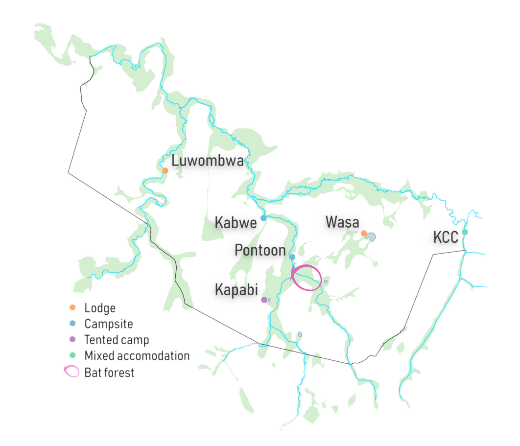
Cartography
Tourism Map
An eye-catching and aesthetically pleasing map designed for customer-facing promotional materials.
It is present on the Kasanka Trust website.
Zimbabwe
Spatial Analysis
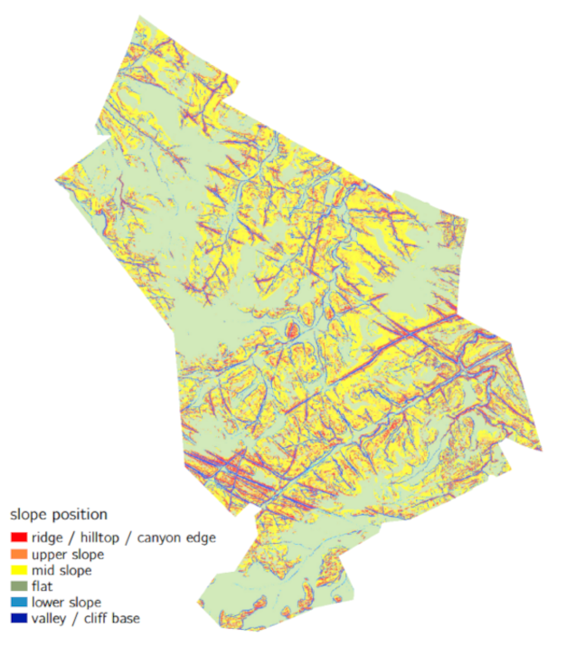
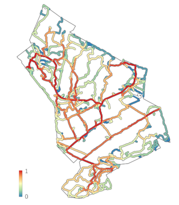
Wildlife Water Access Modelling
An accessibility model developed to map wildlife movement potential towards critical water sources in rugged terrain. By adapting Tobler's Hiking Function within a GIS framework, the analysis provides insights into terrain-based travel costs, resource availability and habitat connectivity.
Netherlands
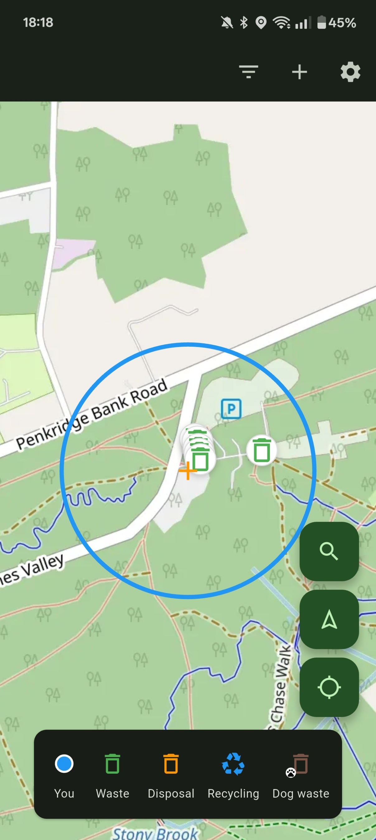
GIS Development
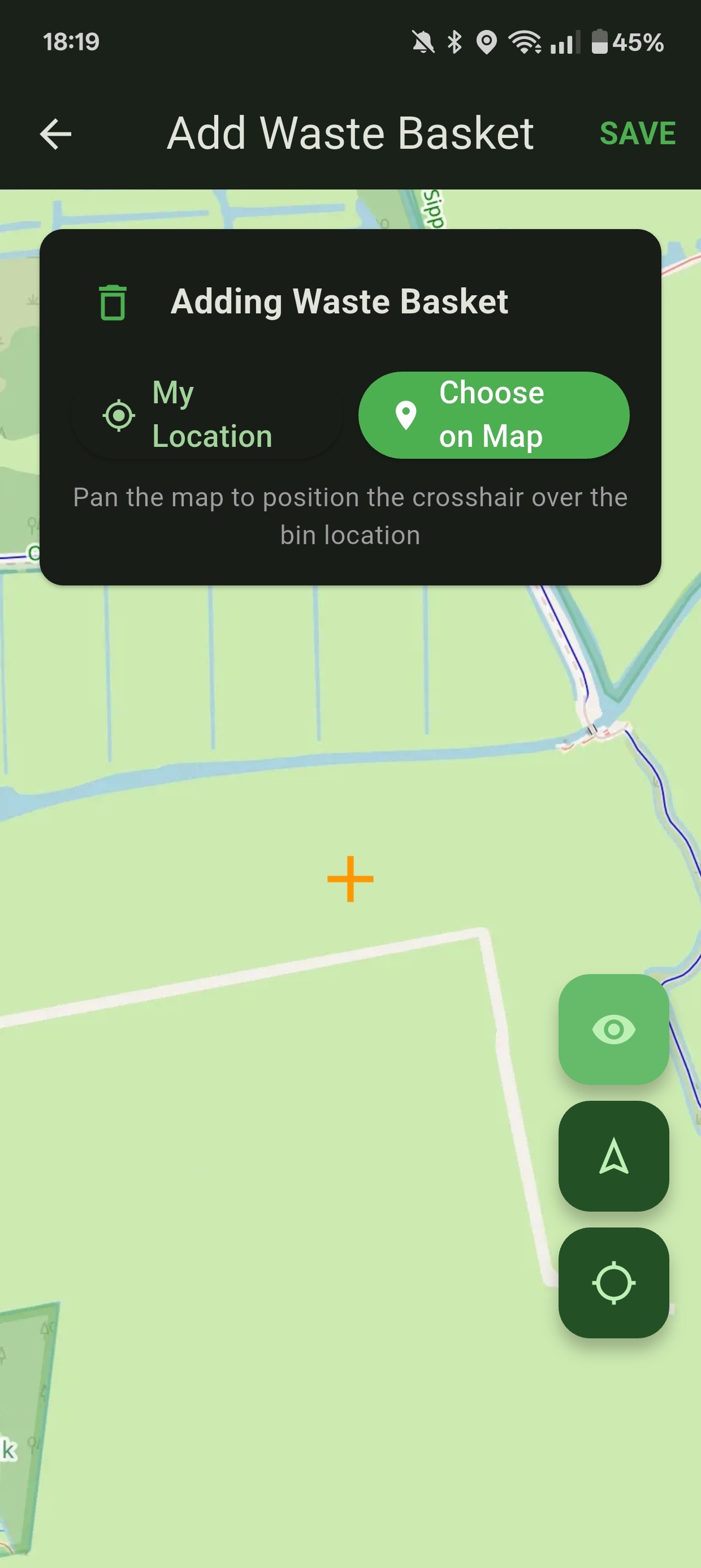
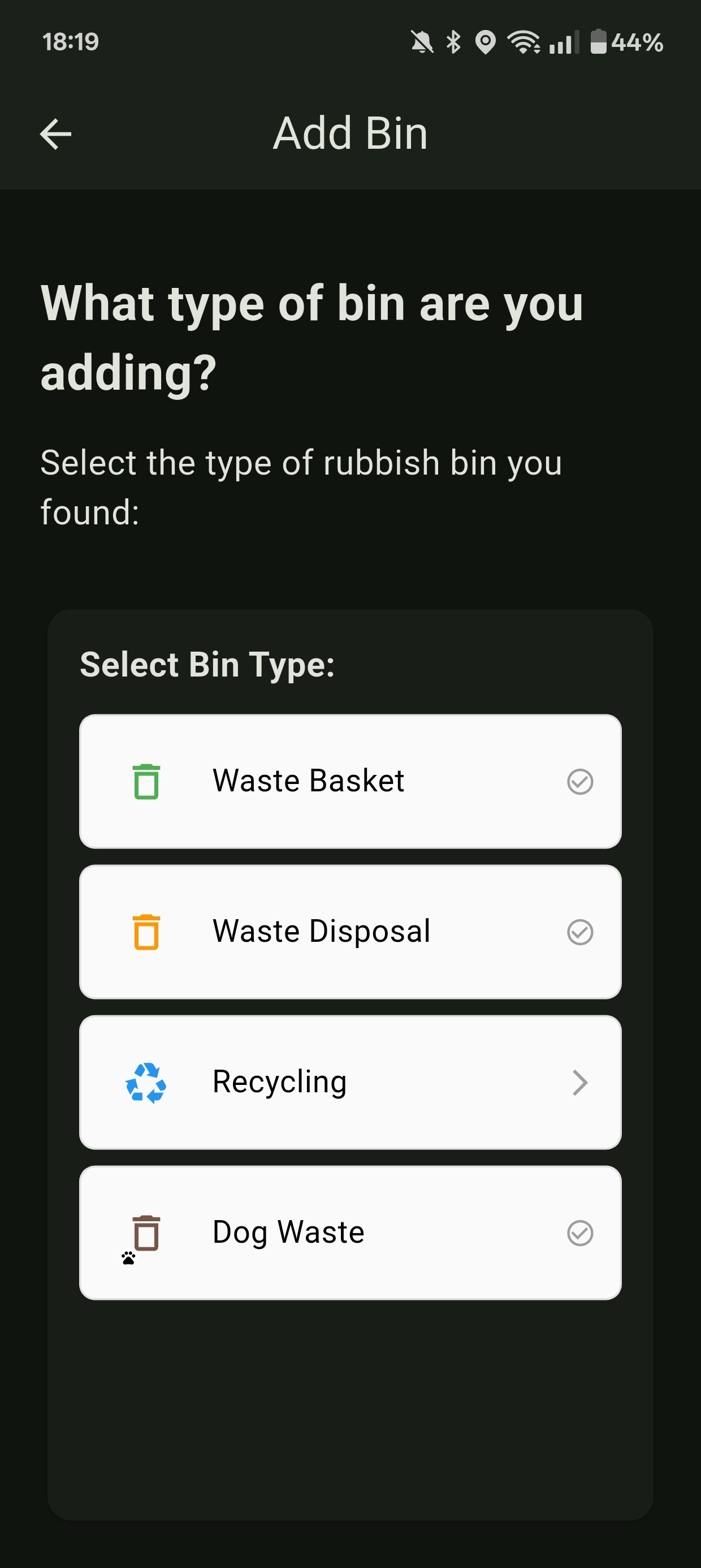
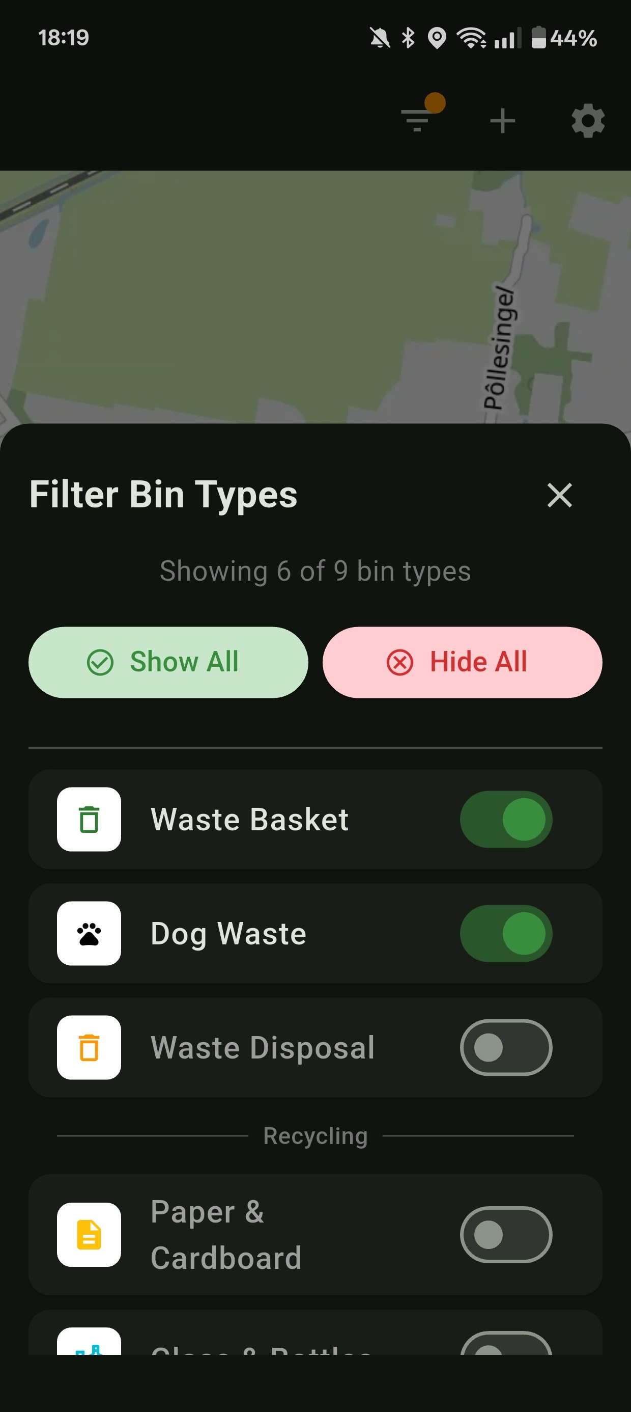
BinWhere: Mobile app
A community-focused mobile app. Have you ever been out and about and ended up carrying an empty bottle or a bag of dog poop, not knowing where the nearest recycling point or waste bin is? BinWhere can help you find the nearest one in seconds. Based on OpenStreetMap data, it works globally.
Dutch Caribbean
Scientific Analysis
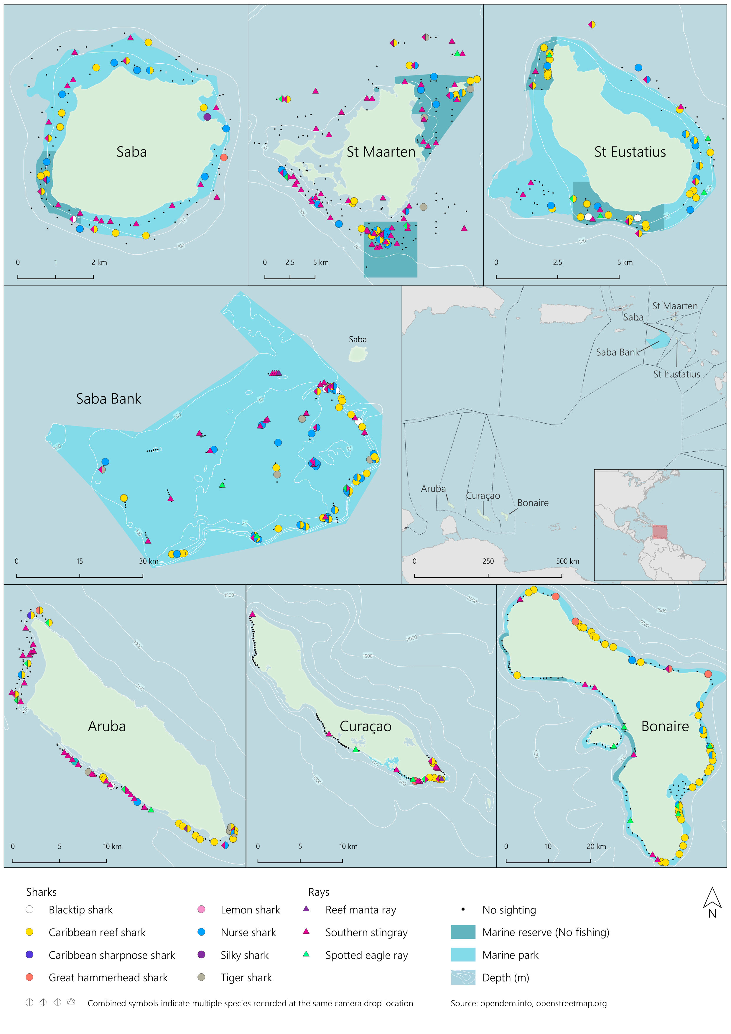
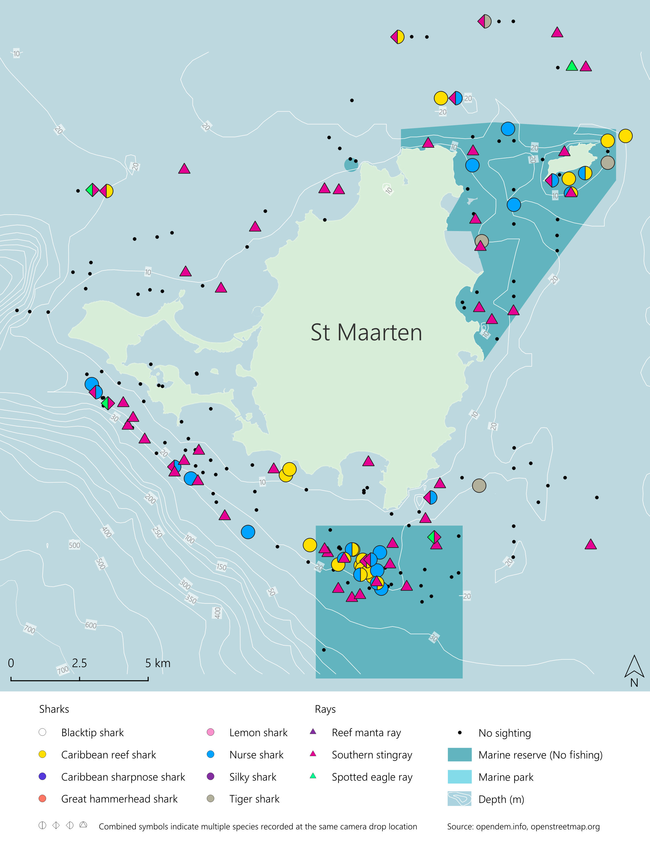
Marine Predator Spatial Dynamics
Comprehensive geospatial analysis for a scientific study published in the 'Journal of Applied Ecology'. The project maps the relationship between human activity and the spatial distribution of reef shark populations, providing a visual evidence base for marine conservation.
South Africa
Conservation Science
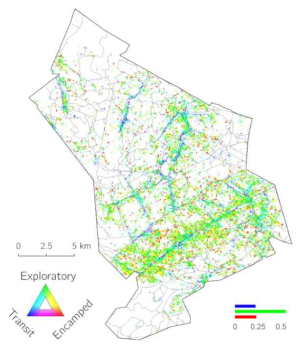
Megaherbivore Movement Ecology
An analysis of elephant movement ecology and road-traffic interactions in Welgevonden Game Reserve. By inferring elephant behaviour from satellite collars through Hidden Markov Models and comparing with vehicle GNSS telemetry, the study identifies critical behavioral refuge zones and interaction hotspots to improve wildlife management and safety.
Tools

QGIS Plugin
Polygon from Map Extent
An ultra-lightweight QGIS plugin to generate geometry from current map viewports. Designed for rapid AOI creation, it leverages the project CRS to create persistent virtual layers in a single click.
QGIS Plugin
Select Matching Features
A productivity tool that streamlines complex selection workflows. By simply clicking a reference feature, it automatically selects all features with matching attribute values across the dataset, including advanced operator support.
QGIS Plugin
Rotate Marker Symbol
Bespoke rotation tool for precision cartography. It allows users to rotate point symbols towards a specific focal point with a live guidelines and semi-transparent previews, making it ideal for orienting assets like cameras or road signs.
Have a geospatial challenge?
Let's solve it together.